
The author in front of the now closed Lana’s Hangar Cafe In Hoquiam, WA to show that he had successfully completed the first 1/2 of his first solo cross country flight.
Today marked another milestone in my journey to become a private pilot. Today I did my first solo cross country flight. No I didn’t fly from Washington to Florida. A cross country flight is defined as a flight that is more than 50 nautical miles from your home airport. This is a pretty big deal. This is where you really put all your skills to the test. Can you successfully navigate from your home airport to another airport dozens of miles away using all the skills you’ve learned so far? Of course you have to know how to takeoff, fly and land the plane. It seems as though that’s all you’ve been practicing for weeks. But can you use pilotage and dead reckoning? Can you navigate the dozens of frequencies on the radio you’ll need to get from point A to point B? How about using the E6-B flight computer to calculate ground speed and wind correction angles? Can you use the VOR to find your exact location on the map? Can you talk to towers and flight services on the radio without sounding like an idiot? How about filing, opening and closing your flight plan? This is the day you get to put it all together. And I DID IT!!
Teri told me that it didn’t seem like I was overly excited when I got home. And I guess I probably wasn’t. Not because I don’t think this is a big deal, because it is. But simply because I’ve been training for this for months. It was pretty much a non-event, except for the fact that THIS is why I want to be a pilot! I dream of the day I can just rent the plane and Teri and I can go to Friday Harbor for lunch. Or when my friends and I can go to Wenatchee for golf. Or when I have a client in from out of town that wants an even better overview of the area. The freedom flying gives is what I long for!
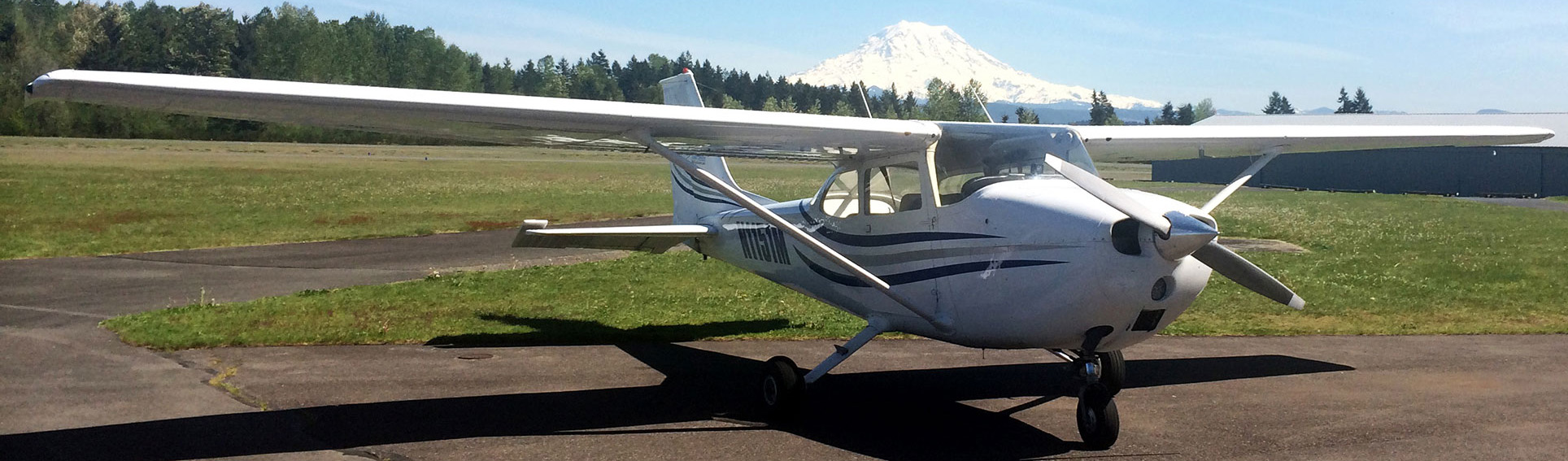
My flight was scheduled for 1PM, and as always, I arrived at the airport early so my instructor could review my flight plan and hopefully give it her blessing. The plan today was to leave Thun field, overfly McChord (meaning I get to talk to the controller there), at Anderson Island, hang a left to KOLM (Olympia Airport), head west over the Satsop nuclear cooling towers and on into KHQM (Hoquiam). For the return flight, I’d take off out of KHQM and head West to Ocean Shores, do some sightseeing, then turn back East overflying the cooling towers again on to KOLM. From there I’d head South to Tenino to avoid the Rainier MOA (Military Operations Area) then turn East again to Eatonville and finally North back to Thun.
After reviewing my flight plan, my instructor signed off two endorsements in my log book. One for my initial solo cross country flight and one specifically for THIS cross country flight. Sweet! Good to go! I headed out to the plane, did my preflight and I was off! First call on the radio was to Flight Services to open my flight plan that I had filed on my iPad using an application called Foreflight. After that I switched frequencies to the McChord Tower to request permission to transition their airspace. I dialed in the frequency 124.4 and put that in my #1 Com.
“McChord tower, Cessna 84823 approximately 5 miles east of you at two thousand five hundred requesting permission to transition your airspace east to west”
“Cessna 823, Olympia Tower, wrong frequency, One Two Four Point Eight”
“OOPS! Sorry about that!”
So I sheepishly dialed in 124.8 on COM #1 and repeated…
“McChord Tower, Cessna 84823 approximately three miles to the east at two thousand five hundred requesting permission to transition your airspace east to west”

Gotta Love Those C-17s!!!
“Cessna 84823, McChord Tower, transition approved, thank you”
I was kind of bummed he didn’t give me a discrete transponder code, but happy for the shortcut! I overflew McChord and when I was just at the edge of their airspace:
“Cessna 823, McChord Tower, say position ”
“Approximately one mile east of Puget Sound”
“Roger 823, frequency change approved good day”
“Cessna 823, thank you sir, good day”

Mount Rainier in the distance, over Puget Sound at 4,500 feet.
And just like that I was kicked to the curb! I pushed the throttle in and started my climb. Off in the distance I saw a Chinook heading in to Gray Army Airfield. My flight plan had me at 4,500 feet and I was stoked! The sky was blue, the sun was glinting off the Puget Sound, the air was smooth. It was a perfect northwest day for flying! As I reached Anderson Island, I headed south and I could see the Olympia airport in the distance. As I already had their frequency in standby on COM 1, I switched to that and listened to the traffic coming into and departing from KOLM. One guys plane type was “Warbird” and I was really curious to see what that was. From 4,500 feet, I could see him land, but couldn’t make out the aircraft type.

Satsop Cooling a Towers and the Author’s club hand in the reflection…
A gentle right turn to the west and I could see the Satsop Cooling Towers in the distance. I kept my altitude at 4,500 and did a ground speed check between Olympia and Satsop. I had apparently picked up more of a headwind than was forecast because I was a couple knots slower than I had planned. I could see Aberdeen and the surrounding area, so I knew I was headed in the right direction. About 15 miles out from Hoquiam, I started my descent. Carburetor heat on, power back to 2,200 RPM and a nice 500 feet per minute descent. I leveled off at about 2,500, dialed in the frequency for the Hoquiam common traffic and announced:
“Hoquiam Traffic, Cessna 84823 10 miles to the east, will be maneuvering for the 45 for runway two four, Hoquiam”

Aberdeen and Hoquiam … Airport in sight!
I headed south east over the prison, it must have been activity time because lots of inmates were in the yard. Just past the prison, at about 1,200 feet I turned toward the Northeast and announced “Hoquiam Traffic, Cessna 84823 3 miles to the south, turning on the 45 for runway two four, Hoquiam”. I dropped another 200 feet of altitude and announced I was turning on the downwind. As I passed by the numbers, I cut my power to 1,500 RPM, twist of nose up trim and dropped my first notch of flaps. I called my turn to base, dropped another notch of flaps, and as I turned final, I coud see that I was still too high. Dropped in the last bit of flaps and cut my throttle all the way to idle. My speed was good and even though I landed long due to being high, the landing was as pretty of one as I’ve made. Centerline and just kissed the pavement! Had the runway been a LOT shorter I would have gone around for another lap, but since I was the only one there and the runway is ginormous, I wasn’t too concerned.

Ocean Shores
I parked and shut down the plane. I took the obligatory selfie and sent it to my instructor to let her know I had arrived safely. I called flight services and closed my flight plan. I used the facilities, and called my wife to let her know too that I was on the ground and safe. Finally it was time to hop back in the plane and head home. Do my runup, taxi onto runway two four and I’m off! With a nice headwind the plane lifted off quick, and wanted to climb, so I let her! I leveled off at 2,500 feet and headed west towards Ocean Shores. From the time I was 7 until I was 33 my family had property in Ocean Shores. I’ve been going there since I can remember. So it was really neat to be able to see it from the air!! I can’t wait until I’m confident enough to land there. I won’t lie, I was tempted today! My instructor forbade me from flying over the Pacific, so I stayed on the bay side of OS, which was fine.

Westport
After some quick sight seeing I turned back east and began my climb to 5,500 feet. Soon enough I was over the cooling towers again. I dialed in the Olympia VOR and the Hoquiam VOR to show that I could actually use them to navigate. It wasn’t the best test since you’re really on a line between the two and it’s not really triangulation IMHO but I did it anyway. At KOLM I turned south to Tenino, then East toward Eatonville. When I reached the Eatonville airport, I turned North and could see Thun field all the way from Eatonville!! Visibility was awesome today!

Mount Rainier from Eatonville
Over Graham I announced I was 10 miles to the south and would be maneuvering for the 45 for runway three four. I again announced my position over the Boeing Frederickson plant, and again as I was turning on the 45. I forgot to call downwind, but base and final were good. I even remembered my prelanding checklists on the way out and back today!! Pretty stiff 90 degree angle crosswind today, but my landing was fine. Pretty much centerline! I think I might be working that kink out finally too! I taxied for the fuel pumps, filled up the plane and went to grab the golf cart to pull it back to the parking spot. After I secured the airplane, my friends, Chris & Krysta texted me to let me know they didn’t know you could pull a plane with a golf cart! They had been having lunch at the Hangar Inn and saw me. Too funny!!
All tolled I was in the plane 2.4 hours today. Combined with the 2.5 yesterday and my two 1.0 hour solo flights this week that’s nearly 7 hours flying this week!! Tomorrow my instructor and I are doing some night flying, which I’m super stoked for!
One Comment on “First Solo Cross Country Flight!”
So when is it you get to fly to SB?